Bridging the Gaps in Transit Data
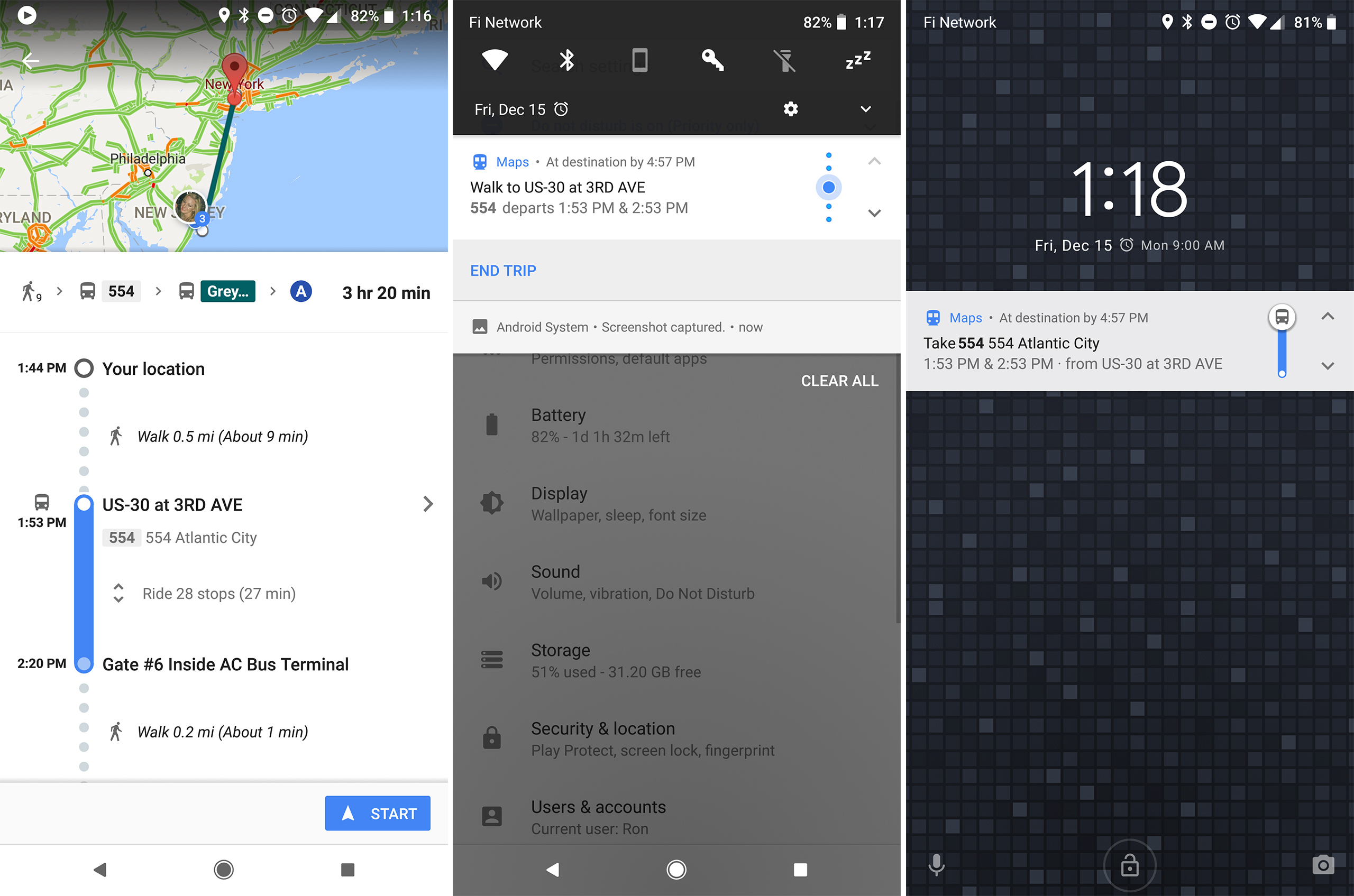
Google Maps does not consider all transit options when providing directions. International trains, some intercity and regional trains, ferries, and private bus or coach services are often omitted from route planning. Flights are also excluded from transit directions between locations in different countries or regions. This can leave gaps in longer distance journeys that require combining multiple modes of transportation.
Intercity and Regional Train Routes
Within a country, Google Maps may provide transit directions using intercity or regional passenger rail lines. However, it will not always find the optimal route if some train services are missing from the underlying transit data. Regional rail network details may be incomplete, especially for smaller communities or lines with less frequent service. When planning a trip involving trains, it is worth double checking schedules directly on the rail operator’s website.
International Rail and Ferry Links
For international trips, transit directions typically will not include cross-border rail or ferry options. If traveling between countries connected by rail tunnels or vehicle carrying ferry routes, the user must bridge this gap. Google Maps recognizes national borders as hard boundaries in its transit database. To route across, the start and end points need to be on opposite sides of the border connection.
Private Intercity Coach and Bus Companies
Many areas have private intercity bus or coach operators providing affordable long-distance transport links. However, schedules for these private bus lines may not integrate with public transit feeds. Unless the routes and timetables are published in an open data format, Google Maps will be unaware of them as potential connections. This leaves some transport options invisible to route planning tools.
Flights Between Distant Locations
The limitations become most apparent for planning travel over very long distances or between locations in different countries/regions not connected by any continuous transit or ferry network. Transnational flights are the only realistic option in these cases but are excluded from transit directions. Google Maps can appropriately only provide driving or walking directions between airport locations.
Incomplete Local Transit Network Data
Even within a single city, Google may lack complete schedule information for some municipal bus or rail systems. Where local transit agencies have not published GTFS data, certain lines or stations will be absent from route planning and trip duration estimates. Users in such areas should contact their local transit authority about making schedule feeds openly available.
Bridging Data Gaps with Alternative Route Segments
When Google Maps transit directions hit one of the above data limitations, the user needs to find alternate route segments to bridge those gaps. A multi-step process is often required:
Identify Gaps in the Google Maps Route
Carefully examine any route returned and note where it ends prematurely or suggests implausible alternatives like very long walks. These indicate a gap where data is missing for part of the full journey.
Research Direct Connection Options
Consult online timetables and route maps to identify reasonable transport links connecting the gap endpoints identified. This may involve private regional buses, ferries, or flights between major nearby cities.
Plan “Bracket” Routes Around Gaps
Input address-to-address transit directions requests, starting and ending as close as possible to the gap boundaries. This will find viable routes for the “brackets” on either side of the gap to properly bound it.
Combine Bracket Routes with Direct Gap Connections
Cross-reference schedules to manually develop an optimal one-way or return itinerary incorporating all segmented route pieces identified. Allow ample transfer time between connections.
Consider Alternate Departure/Arrival Times if Needed
Some schedule adjustments may be needed to integrate connection times across operator boundaries. Earlier/later departures could provide better through-journeys than the default first/last options. With a bit of extra research, patient users can fill in the white spaces that remain in Google Maps transit planning capabilities. By combining its automated routing with supplemental schedule data, comprehensive multi-modal trips of any distance can be realized.
Data Coverage Continues Expanding
As open data standards gain traction worldwide, more transit providers are making their GTFS feeds available. Over time, this will shrink the size and frequency of coverage gaps faced by online route planners. But for now, a bit of extra legwork may still be needed to bridge certain data limitations.
Limitations when Planning International Itineraries
Even for trips within the coverage of a major transit network, some international routes will exceed Google Maps’ planning abilities. A few other limitations to keep in mind:
Lack of Multinational Transit Data Integration
Google draws on individual country or regional transit datasets which may not interconnect seamlessly across borders. Major transfers between one national network and another can be difficult to capture in a single routing solution.
** language and Currency Barriers**
Transit information displayed, like station names and fare costs, will always be shown in the default language and currency format of whichever country segment is being viewed. This risks inconsistencies or confusion when moving between different systems as part of a longer journey involving multiple nations.
Immigration and Customs Requirements
Google Maps recognizes international borders only as physical boundaries in its data, not legal transitions with documentation controls. It will not factor in checkpoints, transfer corridors, or specialized immigration-friendly services like bus/train combinations geared for cross-border commuters. Time clearance must be factored.
Variations in Boarding Policies and Station Amenities
Comfort levels may differ substantially when transferring between certain national rail or bus/coach networks. Policies around prepaid tickets, seat allocation, baggage storage, and onboard facilities can vary in unforeseeable ways depending on the specific international route taken between two distant points. With the right strategy, these hurdles may be overcome to some degree. But for extremely long international itineraries spanning multiple transit systems across language and policy borders, the only viable option is often to piece together separate domestic route segments supplemented by flights in place of cross-border connections. Google Maps alone cannot replace detailed multi-leg trip planning for such complex journeys involving intercontinental travel.
Conclusion
While Google Maps has vastly expanded access to transit routing capabilities, limitations remain whenever data from different providers must be stitched together to complete an itinerary. Gaps will continue to exist around private operators, cross-border services, and less frequent routes requiring intermodal transfers over long distances or between countries. With supplemental research skills, workarounds can be devised. But for the foreseeable future, online journey planners will likely require user assistance bridging certain coverage seams, especially in crafting truly international transit itineraries. Transit agencies also play a role by agreeing on open standards to share schedule information across borders wherever through services deliver a more sustainable travel option compared to point-to-point flights. While far from perfect, a combination of routing tools and traveler resourcefulness can still realize most low-carbon mobility needs.
 How Leisure Travel Has Evolved Over Time